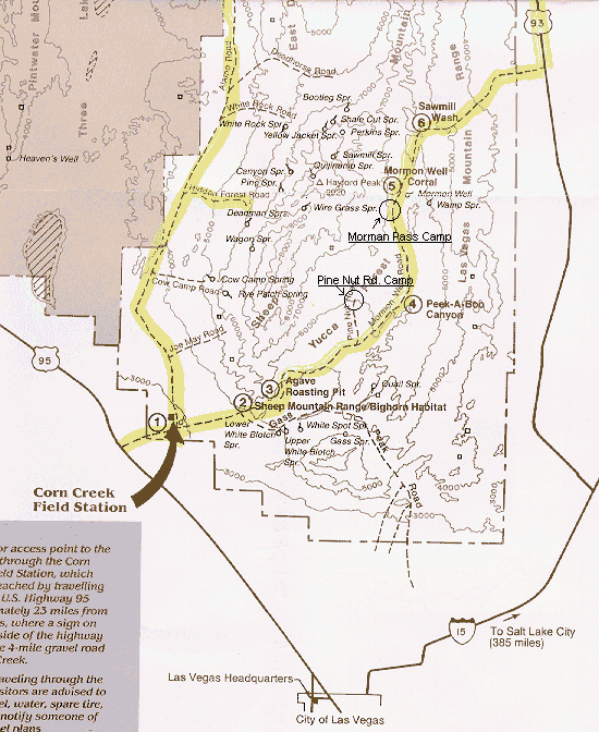
This is a map of the area where we often go camping. The area is the "Desert National Wildlife Range". It provides habitat for Bighorn Sheep and the north western half (dark on the map) is Nellis AFB shoot-em up area. Camping is allowed anywhere within 100' feet of the road. It's just north of Las Vegas. Above 6000 feet there is Pinon Pine, White Fir and Juniper. It is dry forest but very nice in the spring and fall. Two camps we've made are marked along the eastern road at about Ref. #4 and Ref. #5. The road is rocky but passable. For reference the eastern route covers about 40 miles between Hwy 95 and Hwy 93. We spent last Memorial weekend at Mormon Pass and only saw 3 vehicles in 3 days.
